U.S. flag

An official website of the United States government

Official websites use .gov
A .gov website belongs to an official government organization in the United States.

Secure .gov websites use HTTPS
A lock ( ) or https:// means you’ve safely connected to the .gov website. Share sensitive information only on official, secure websites.

New Land Use Map Available

caution sign The information on this page may be outdated as it was published 9 years ago.

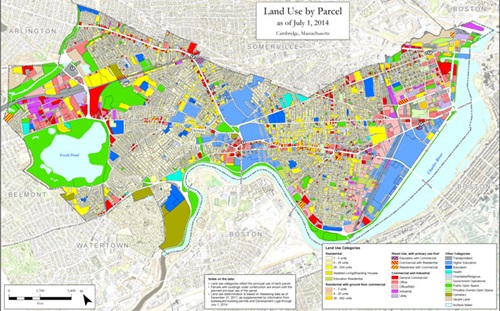
Cambridge land use map as of July 1 2014

A newly an updated land use map of Cambridge is now available for review.  The map shows the predominant land use of each parcel as of July 1, 2014.  The land use indicated reflects both existing uses and buildings currently under construction.  The data behind the map is drawn from Assessing Department data and is supplemented with information taken from the Development Log and building permits issued by the Inspectional Services Department.

View the Land Use Map here.

For More Information

For more information contact Cliff Cook, Planning Information Manager, at 617/349-4656 or ccook@cambridgema.gov.

Page was posted on 5/8/2018 6:26 PM
Page was last modified on 8/22/2023 5:01 PM
Contact Us

How can we help?

Please provide as much detail below as possible so City staff can respond to your inquiry:

As a governmental entity, the Massachusetts Public Records Law applies to records made or received by the City. Any information received through use of this site is subject to the same provisions as information provided on paper.

Read our complete privacy statement


Service Requests

Enter a service request via SeeClickFix for things like missed trash pickups, potholes, etc., click here