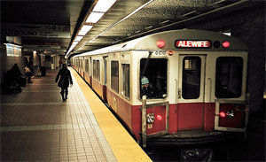
On Saturday, October 11, the Massachusetts Department of Transportation (MassDOT) will close the Longfellow Bridge to all motor vehicle travel, except MBTA buses. Buses will replace Red Line trains for service between Kendall/MIT Station and Park Street Station, with a stop at Charles/MGH Station. Red Line trains will resume service on Sunday morning, October 12. The diversion is necessary for MassDOT’s design/build contractor, White-Skanska-Consigli JV, to perform work in close proximity to the Red Line tracks that is not possible during MBTA service hours. Please visit the MBTA’s service updates webpage for additional information.The bus route and stops are shown on this map. All shuttle bus stops are accessible for people with disabilities.
MBTA buses will be the only motor vehicles permitted on the bridge. All other motor vehicles, including passenger vehicles, trucks and all other buses, will need to use one of two routes to reach Boston. One route uses Memorial Drive westbound to make a U-turn at Ames Street for access to Memorial Drive eastbound to Land Boulevard and Charles River Dam Road (Monsignor O’Brien Highway/Route 28) to reach Leverett Circle. A second route uses 3rd Street and Binney Street to reach Land Boulevard. Truck restrictions are in place for Memorial Drive.
Emergency response, bicycle and pedestrian access will be maintained across the bridge during this weekend diversion. Please note: Bicyclists must walk their bikes on the sidewalk across the Longfellow Bridge to ensure the safety of all bridge users. The Massachusetts Avenue Bridge and Dr. Paul Dudley White Bike Path across the Craigie Dam Bridge can be used as an alternate route to ride bicycles across the Charles River.
The Cambridge-bound detour remains in place using a signed route from Charles Circle following Charles Street to Leverett Circle, Monsignor O’Brien Highway/Charles River Dam Road and Edwin H. Land Boulevard.
The Longfellow Bridge, which connects Boston and Cambridge over the Charles River, is being rehabilitated as part of a three and a half year, $255.5 million effort funded through the Patrick Administration’s Accelerated Bridge Program. Rehabilitation of the iconic “salt and pepper” Longfellow Bridge will improve structural integrity and capacity, meet modern codes, including ADA accessibility, and create a safer configuration for more modes of travel.
For more information on the project and traffic management plans, visit the website at www.mass.gov/massdot/longfellowbridge. For questions, to report issues and concerns related to construction or to be added to the project email distribution list, please call the project hotline at 617-519-9892 or email longfellowbridge@state.ma.us.
For transportation news and updates visit MassDOT at our website: www.mass.gov/massdot, blog: www.mass.gov/blog/transportation, or follow MassDOT on Twitter at www.twitter.com/massdot and Facebook at www.facebook.com/massdotinfo.


 The information on this page may be outdated as it was published 9 years ago.