Census Boundary Map Gallery
The boundaries of US Census geographic divisions within Cambridge (census tracts, block groups, and blocks) are shown on maps listed below.
To find maps displaying demographic data by census tract so to the Census Tracts Demographics page.
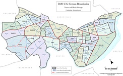 |
2020 Census Boundaries
The boundaries used in the latest Census are detailed on this 11” x 17” map. Census tracts and block groups are outlined and labeled. Neighborhood boundaries are added for reference.
|
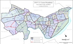 |
2010 Census Boundaries
The boundaries used in the latest Census are detailed on this 11” x 17” map. Census tracts, block groups, and blocks are outlined and labeled. Neighborhood boundaries are added for reference.
|
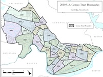 |
2010 Census Tracts
Cambridge was divided into 32 census tracts for the 2010 US Census. This letter-sized map shows the tract boundaries.
|
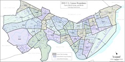 |
2000 Census Boundaries
This is a larger format map that shows the boundaries used in the 2000 US Census. Census tracts, block groups, and blocks are outlined and labeled.
|
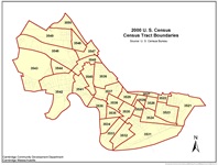 |
2000 Census Tracts
Cambridge was divided into 30 census tracts for the 2000 US Census. This letter-sized map shows the tract boundaries.
|
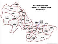 |
1990 Census Tracts
The boundaries of the 30 tracts used in the 1990 US Census are shown on this letter-sized map.
|
For More Information
For more information about these maps and about GIS contact Brendan Monroe at 617/349-4641 or bmonroe@cambridgema.gov.
For more information about Cambridge census data contact Cliff Cook at 617/349-4656 or ccook@cambridgema.gov.