The Port/Area Four

Green Rose Park on a sunny day in spring

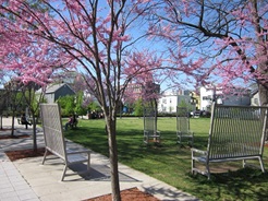
The Port, formerly known as Area Four, is a high-density residential neighborhood with around seven thousand residents, bounded by Hampshire Street to the north, the Boston & Albany Railroad to the east, Prospect Street to the west, and Massachusetts Avenue to the south. The major commercial center and transit center of The Port lies in Central Square with the main commercial strip along the Massachusetts Avenue edge, while smaller commercial areas exist along Main Street, Prospect Street, and Hampshire Street. Most of The Port is residential in character. However, the triangle in the southern part of the neighborhood bounded by Massachusetts Avenue, Main Street, and the Grand Junction Railroad (sometimes known as the Osborn Triangle) is a former industrial center now home to high-tech labs and offices, as well as facilities for the neighboring Massachusetts Institute of Technology.

The Port Neighborhood Map 

The Port/Area Four 3D Map

The Port Statistical Profile


The objective of a neighborhood study and subsequent updates is to identify planning issues in the neighborhood and articulate recommendations to address those issues. The study recommendations are the key part of the neighborhood study and updates. The recommendations are used not only to guide neighborhood planning efforts for the Community Development Department but in many cases are included as work items for other City departments when appropriate.

Please note that Area Four was formally renamed the Port in 2015.

2010 Neighborhood Study Update

The final report for the 2010 Area Four Neighborhood Study Update is available. The document includes information presented and discussed at our public meetings, a set of recommendations based on community comments and feedback, and information about how recommendations will be addressed over time through ongoing programs or specific future actions.

2004 Neighborhood Study Update

Between 2001 and 2002 the Community Development Department held four public meetings with neighborhood residents. At these forums Department staff reviewed changes that occurred in the neighborhood since 1995 and residents offered recommendations to improve the way that the City addresses a variety of issues. In addition, the neighborhood planning staff reviewed the status of recommendations from the original neighborhood study.

In 2004 the Department published the Area 4 Neighborhood Study Update: Summary, Recommendations, and Action Plan, which reviews the discussions at the four neighborhood meetings, describe recommendations proposed there, and updates the status of recommendations from the 1995 study.

1995 Neighborhood Study

The original neighborhood study was conducted in 1992 and issued in 1995.

To request a printed copies of any neighborhood study please call Tracey Joyce in the Community Planning Division at 617/349-4650 or email her at tjoyce@cambridgema.gov

  • Main Street Afordable Housing

    Area Four homeownership housing opportunity along Main Street.

  • Area Four neigborhood street

    Norfolk Street residential area located in Area Four.

  • Broadway Retail Cluster

    Small retail neighborhood cluster located on Broadway.

  • Pine Street Tot Lot

    Cherry Street tot lot.

  • Harvard Street homeownership units.

    Harvard Street homeownership units.

  • Washington Elms housing

    Washington Elm housing community.

  • Sennott Park located on Broadway between Prospect and Norfolk Street
  • Greene Rose Heritage Park located on Harvard Street between Moore and Windsor Street
  • Clement G. Morgan Park located at the corner of Washington and Columbia Street, and Anthony Paolillo Tot Lot located on Pine Street across from Clement G. Morgan Park
  • Squirrel Brand Park located on the corner of Boardman and Broadway
Map of Cambridge Parks and Playgrounds

Neighborhood Planner: Lev McCarthy, lmccarthy@cambridgema.gov, 617/3499164.