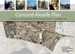
Concord Alewife

Concord Alewife Plan report cover

The Concord-Alewife Rezoning and Design Guidelines were adopted by the City Council on June 26, 2006. The changes have been incorporated into the Cambridge Zoning Ordinance and Zoning Map.

With adoption of the Concord Alewife zoning, the City Council has taken a significant step toward creating a much more vibrant, mixed-use Concord Alewife area – an area more in keeping with the rest of Cambridge – while respecting the area’s importance as an incubator of new businesses.

The vision for the area is to encourage a mix of uses that over time will enliven the area, create an identity and sense of place, and take advantage of the area’s proximity to transit and to open space resources.


June 2014 - Concord Alewife Transportation Update

On June 19, 2014 the Cambridge City Council Subcommittee on Transportation and Public Utilities asked the Community Development Department to “address the traffic, transportation and access to transit issues in the Fresh Pond/Concord Avenue/Alewife area with a view toward understanding the impact of recent development trends in the area.” Staff created and delivered a presentation (found in the Documents Tab and below) at the Tobin School meant to give the Council and public an understanding of how the transportation elements of the Concord-Alewife Plan were being implemented, an understanding of current development taking place and its impact on area transportation, an explanation of the nature of Alewife transportation and vehicle trips, as well an update on recent trends and projects that the City and others have completed, are in progress and hope to pursue in the future.

Click here to view the Alewife Transportation Update (2014) presentation given on June 19, 2014 to City Council Subcommittee on Transportation and Utilities at the Tobin School.


In January 2003 the City embarked upon a multidisciplinary planning study of the Concord-Alewife area in the western part of Cambridge, including the areas known as the Triangle, the Quadrangle, the Fresh Pond Shopping Center and the Cambridge Highlands. The Study Area is bounded by the southern edge of the Alewife reservation, Alewife Brook Parkway, the Fitchburg line of the commuter rail, the Watertown rail line, Concord Avenue, and the Cambridge/Belmont city line. In December 2002, the City Manager appointed a Study Committee to guide this planning study. The Study Committee includes neighborhood residents, representatives of study area businesses, property owners and institutions, and City staff. The study aims to create a long range vision and plan for the Concord-Alewife area through a participatory process with the Concord-Alewife Planning Study Committee.

City staff and the Study Committee worked closely with a team of professional planning consultants, led by Goody, Clancy & Associates, to address a variety of planning issues. Key issues addressed by this study include the appropriate mix of uses, including housing, industry, possible City uses, and open space; access and traffic; the character of future development; and needed zoning changes to accomplish study goals.

The analysis and recommendations developed during the study process are summarized in the Concord-Alewife Plan. Based on the zoning recommendations of the Concord-Alewife Planning Study Committee, the Planning Board submitted the Concord-Alewife Rezoning Petition to the City Council on April 25, 2005 -- the Concord-Alewife Rezoning and Design Guidelines were adopted by the City Council on June 26, 2006.

In September 1997, the City began to develop Citywide Growth Management policies and zoning recommendations. This process culminated in several major zoning proposals, which were adopted by the City Council in February 2001. The goals of this rezoning were to reduce traffic growth from and impacts of new development, provide opportunities for public review of large projects, increase incentives for housing, and support the City’s economic growth. With the completion of the Citywide Rezoning and the follow-up rezoning of Eastern Cambridge, Cambridgeport (SD-8), and Alewife (SD-4/4A) in 2001 and 2002, the Concord-Alewife area remained the last large area of Cambridge with significant development potential and needing more detailed planning.

In general, densities are lowered for as-of-right development (base districts), and raised to prior levels only with a special permit (6 overlay districts) from the Planning Board. The new zoning:

  • Brings more projects into the special permit process which requires public project review at the Planning Board.
  • Introduces incentives for a significant component of residential living in the shopping center districts, and encourages street level neighborhood scale retail services in the quadrangle and triangle to achieve the desired mixed-use environment.
  • Establishes environmental regulations to better manage stormwater through increased open space (15% of lot) and permeability requirements (25% of lot).
  • Provides incentives for the creation of important infrastructure that will facilitate movement within the area and beyond through new pedestrian paths, roadways, and a new pedestrian/bicycle bridges over the railroad tracks. Density bonuses for infrastructure: doubled for the portion of a lot conveyed to city for roadways; .25 FAR bonus on entire lot for provision of a pedestrian bridge.
  • Protects the Cambridge Highlands neighborhood with a 25- foot planted buffer and by requiring lower heights of buildings in the Quadrangle adjacent to the residential area (35’ height limit within 100’ of Highlands).
  • Through design guidelines associated with the zoning, encourages better pedestrian environment, environmentally sensitive development, and housing types for families of all sizes.
  • Envisions a transformed Fresh Pond Shopping Center with a mix of housing, retail, and other commercial uses in a setting that is pedestrian-oriented, greener and better connected to transit.
    • Store size limit is 50,000 SF, except for a grocery store which may have up to 60,000 SF.
    • Non-residential uses are limited to 50% of total the development.
    • A minimum amount of retail is required.
    • Permits transfer of development rights (generally from west to east) to move development closer to MBTA service.
      • Donating lot can be used for residential, public park or R&D at .75 FAR, even if all FAR transferred off;
      • Additional height is allowed on receiving lot to accommodate FAR;
      • Transferred FAR capped at 20% of what is allowed on receiving lot.

      Community Development Department
      344 Broadway
      Cambridge MA 02139

      ifarooq@cambridgema.gov

      For more information about the Concord-Alewife Planning Study, please contact Iram Farooq, ifarooq@cambridgema.gov, at 617/349-4606.