Neighborhood Nine

Massachusetts Avenue corridor

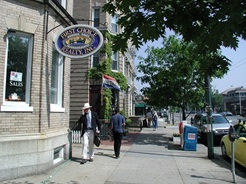
Neighborhood Nine is a moderate-density residential neighborhood with around twelve thousand residents. Harvard Square and Porter Square, both major commercial and transit centers, lie at two corners of the neighborhood. Massachusetts Avenue, which connects the two squares, is one of the neighborhood’s main commercial areas. The Fresh Pond Shopping Center provides a regional commercial area to the west. A smaller commercial strip exists along Concord Avenue. Harvard University is a presence in the neighborhood, with both academic and student housing facilities. Danehy Park, a 50-acre athletics and recreational facility built on the site of the former city landfill, is also located in Neighborhood Nine.

Neighborhood Nine Map 

Neighborhood Nine 3D Map

Neighborhood Nine Statistical Profile


For information about current planning efforts on Massachusetts Avenue bordering Neighborhood Nine see the Lower Massachusetts Avenue Study page.

The objective of a neighborhood study and subsequent updates is to identify planning issues in the neighborhood and articulate recommendations to address those issues. The study recommendations are the key part of the neighborhood study and updates. The recommendations are used not only to guide neighborhood planning efforts for the Community Development Department but in many cases are included as work items for other City departments when appropriate.

Recognizing the need to ensure that the recommendations put forth in the neighborhood studies remain current, the neighborhood planning staff works to update the neighborhood studies, reviewing recommendations to identify those obsolete, completed or remaining to be completed and to establish a schedule for outstanding items. In a more abbreviated version of the original study process, a series of public meetings is held for each update, and a Summary, Recommendations, and Action Plan document is produced.

2010 Neighborhood Study Update

The 2010 Neighborhood Study Update provided an opportunity to report back to the neighborhood on the status and progress made on the previous set of neighborhood recommendations and to get information on any new or outstanding issues facing the neighborhood that should become new recommendations. 

2004 Neighborhood Study Update

The first Neighborhood Nine Study Update, published in 2004, represents the first such update completed for any neighborhood.

Neighborhood Nine Study

This neighborhood study was conducted from 1993 to 1994 and issued in 1996.

To request a printed copies of any neighborhood study please call Tracey Joyce in the Community Planning Division at 617/349-4650 or email her at tjoyce@cambridgema.gov.

  • Harvey Street co-housing

    Successful co-housing in Neighborhood Nine.

  • Corcoran park playground on a winter day

    Corcoran Park playground on a winter day.

  • Masse Hardware, a longtime neighborhood business.

    Masse Hardware, a long time neighborhood business.

  • Typical residential street in Neighborhood Nine.

    Typical residential street in Neighborhood Nine.

  • View of Walden Square high rise.

    View of Walden Square high rise.

  • Residential streetscape in neighborhood

    Residential street in Neighborhood Nine.

  • Cambridge Common 
  • Danehy Park - Bound by Garden, Sherman and New Streets
  • Garden Street Glen/Roethlisberger Memorial Park - Garden Street at the corner of Ivy Street
  • St. Peter’s Field - Sherman Street and Cadberry Road
  • Raymond Park/Corcoran Field - Walden at Raymond Street

Neighborhood Planner: Daniel Wolf, dwolf@cambridgema.gov, 617/349-4618