FBX
GIS File Name
CAMB3D_[Tile Name (ex: E_2)]_FBX_Buildings_fbx.zip
Updated
August 2021
Format
FBX
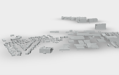
Description
The City of Cambridge Geographic Information System (GIS) City-Wide 3D project provides a detailed three-dimensional model of buildings and bridges has been compiled from many sources over several years. The FBX building model collection provides 3D models for modeling, model transformation, and web visualization. The model collection is segmented into tiles which is contiguous with the City of Boston 3D tile grid. Each model being assigned to the tile that its centroid falls within.
Purpose
The City of Cambridge GIS maintains a 3D model of the city as a visualization and analytical tool for understanding ideas related to the future of the City. The Cambridge 3D model is constructed of several components: Terrain, Ground plan, and 3D models of buildings and bridges. Each of these components is shared in formats intended to facilitate collaboration between diverse communities who have an interest in understanding places in the city as they have changed or as they may be changed.
Download Tiled Data
View 3D Data Download Map
Coordinate System
Projected Coordinate System: State Plane Massachusetts Mainland (Feet), North American Datum of 1983.
Vertical Coordinate System for 3D data: North American Vertical Datum, 1988 (NAVD 88) Feet (Height)
Usage Notes
Be sure to specify units of Feet when importing FBX layers related to the Cambridge 3D model.