Building Model Collection OBJ
GIS File Name
CAMB3D_[Tile Name (ex: E-2)]_2025_BuildingModels_OBJ
Updated
April 10, 2025
Format
Wavefront Format OBJ
Description
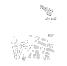
The City of Cambridge Geographic Information System (GIS) City-Wide 3D project provides a detailed three-dimensional model of buildings and bridges has been compiled from many sources over several years. The open-source building model collection provides 3D models that are compatible with open-source tools for modeling, model transformation, and web visualization. The model collection is segmented into tiles which is contiguous with the City of Boston 3D tile grid. Each model being assigned to the tile that its centroid falls within. Each three-dimensional building and bridge model is formatted in Wavefront Object (.OBJ) format.
Purpose
The City of Cambridge GIS maintains a 3D model of the city as a visualization and analytical tool for understanding ideas related to the future of the City. The Cambridge 3D model are of buildings and bridges. Each of these components is shared in formats intended to facilitate collaboration between diverse communities who have an interest in understanding places in the city as they have changed or as they may be changed.
Download Tiled Data
View 3D Data Download Map
Sources
The Cambridge 3D buildings and bridge layer was initially built using aerial photography from Spring 2010. Photogrammetric updates were added based on imagery from 2014, 2018, 2020, and 2021. Photogrammetric development of the 3D building models was conducted by CyberCity 3D.
Coordinate System
Tile Scheme and Coordinate System:
The 5000 foot tile scheme is designed to facilitate exchange of precise georeferenced models and context information among a variety of authoring and presentation tools. The tile network covers the greater Boston area.
State Plane coordinates are offset to keep all coordinates within limits inherent in most 3D design tools.
Projected Coordinate System:
State Plane Massachusetts Mainland (Feet), North American Datum of 1983.
Vertical Datum:
North American Vertical Datum, 1988 (NAVD 88) Feet (Height)
Coordinate System Origin (Offsets)
- X: 731,100MA State Plane Feet
- Y: 2,902,900 MA State Plane Feet
- WGS84 Longitude: 71.223391 W
- WGS84 Latitude: 42.213379 N
- Elevation: 0
- Rotation to align with True North: Clockwise 0.34 Degrees.
Usage Notes
OBJ is a standard 3D image format that can be opened by various 3D image editing programs. It contains a three-dimensional object, including 3D coordinates, texture maps, polygonal faces, and other object information. OBJ files also store references to a MTL (material setting file) that contain surface shading material for the object.