Partnership Development
Partnerships and collaboration with key watershed stakeholders are essential for best managing Cambridge watershed development/urbanization. The Cambridge Water Department is continuously reaching out and partnering with those who prioritize protecting natural resources.
Notable governmental and non-profit partnerships include:
- USGS (United States Geological Survey)
- MassDOT (Massachusetts Department of Transportation)
- Towns of Lincoln, Lexington, and Weston; and the City of Waltham
- Waltham Fire Department
- Lincoln Rural Land Foundation
Local Business Partnerships
In an already urbanized watershed, redevelopment can be a helpful tool for mitigating stormwater impacts. Newer "green infrastructure" technologies such as infiltration basins, rain gardens, and constructed wetlands, as well as older retention/detention ponds, can help increase the travel time for rainwater runoff and can filter out many pollutants before they reach our reservoirs. Early Cambridge Water Department involvement with current and future developments helps ensure that project goals support the City’s water supply protection interests. If conflicts are identified, they can be addressed early in the planning stages which reduces project costs and minimizes development impacts to water resources.
USGS Collaboration
Since the 1990s, the Cambridge Water Department has been collaborating with the USGS on data collection in the three reservoirs and key tributaries throughout the watershed. The Cambridge Water Department and USGS have constructed equipment enclosures that house automated monitoring equipment to record water quality data, water elevation and flow, precipitation, and water supply capacity in the reservoirs. There are also automated water sampling devices at some stations that are programmed to sample a storm event from start to finish. The stations upload data on a near-real-time basis to the USGS’s web-based National Water Information System (NWIS) so that Watershed Division staff can track changes and trends in water quality and quantity. In addition, these stations serve as early warning systems of changes in water quality should unanticipated water quality data be displayed.
To access the USGS data for the Cambridge Water department, click here.
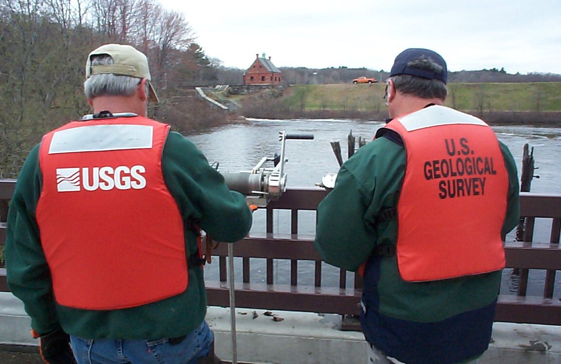
USGS technicians monitoring water quality below the Stony Brook Reservoir.
USGS Water Quality Monitoring Reports
Several reports and fact sheets have been developed as a result of the joint work efforts between the Cambridge Water Department and USGS that describe methodology and results of the research conducted thus far. These reports can be accessed here.
MassDOT Partnership
In 1999, under direction from the state Executive Office of Energy and Environmental Affairs (EEA), MassDOT developed a comprehensive management program to reduce highway impacts to the water supply. The proposed projects under this plan include the following:
- Construct hazardous material/stormwater containment basins at priority outfalls.
- Implement a low salt application and reporting plan
- Implement a routine stormwater infrastructure monitoring and maintenance plan
Continued MassDOT work within the watershed includes stormwater basin construction and improvements along watershed highways, as well as the push for innovative deicing strategies to limit the amount of salt introduced to the watershed.