The City of Cambridge will be redesigning Beech St near the intersection of Elm St to improve pedestrian safety. The new design will create a simpler T-shaped intersection, creating a more predictable experience for everyone passing through.
Background Information
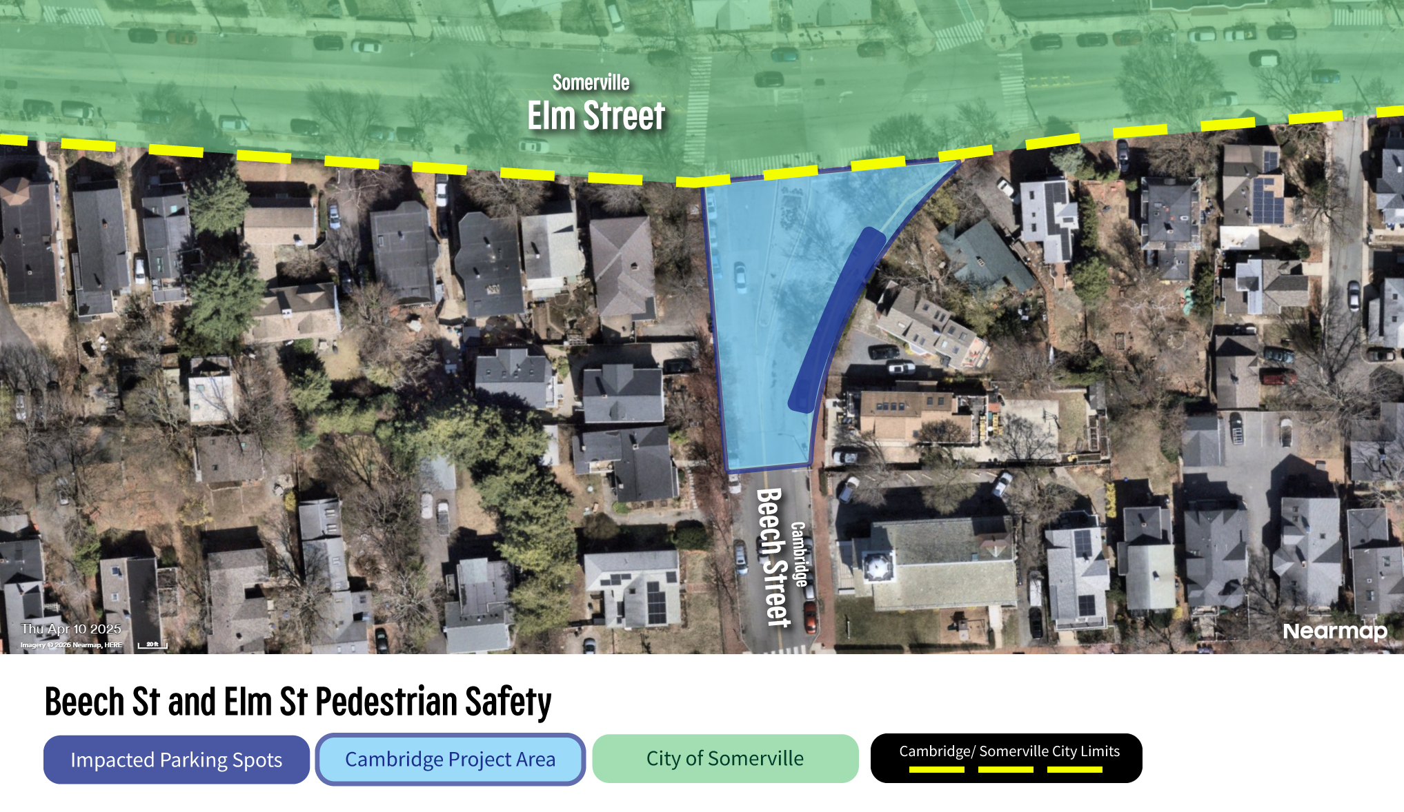
This work is being coordinated with the City of Somerville as part of their Elm–Beacon Connector project. Beech Street is in Cambridge and Elm Street is in Somerville. For information on Cambridge’s plans, visit our project website. For more information about Somerville’s project, visit Somerville’s Elm-Beacon Connector project website.
Benefits and Impacts
The new design will greatly simplify navigating the intersection for all users, whether walking, biking, rolling or driving. This new design includes a smaller intersection with shorter crosswalks, fewer conflict points for drivers, and enhanced use of public space.
This new design will require the removal of about six Cambridge resident permit spaces that are currently available near the intersection.
Timeline For This Work
Cambridge’s work will take place in Summer 2026. Work will include repaving of the street and new markings. Visit the project website to view installation updates.
Community Engagement
Join us on Thursday, May 21 from 5:00 – 6:30 PM at the intersection of Beech St at Elm Street for a Pop-Up Community Meeting. City staff will provide opportunity for feedback, share plans, and answer questions about the project and the design. Learn more here.
If you have a general comment or feedback to share with the project team, please fill out the project’s comment form.
Project Area Map and Project Plans

See the project area map above, indicating where the parking removal will be. Click here to view the project plans.