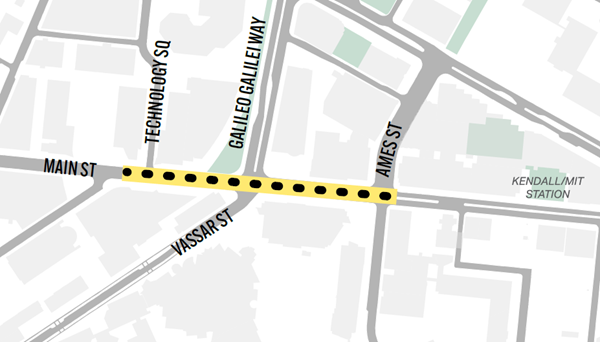
The Department of Transportation is planning separated bike lanes and related street safety improvements on Main Street, from Technology Square to Ames Street, in Fall 2026. See a map of the project area to the right and click here for a larger image.
More About This Project
This work is being done as part of the City’s Cycling Safety Ordinance. The main goal of this project is to install separated bike lanes on each side of the street using quick-build materials, such as flex-posts and pavement markings. We will:
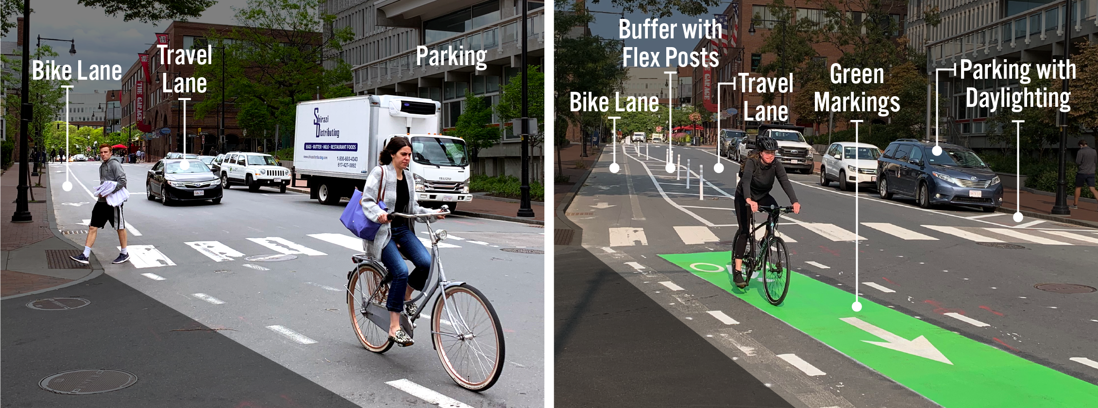
- Install Separated Bike Lanes: To create a separate space for people biking, a bike lane will be installed at the curb. Parking will be moved into the street.
- Improve Intersection Safety: Add turn signals at the Vassar Street and Ames Street intersections to better separate how drivers and pedestrians move.
- Reduce and Repurpose Parking: Remove some metered parking spaces and repurpose others for loading, pick-up, and drop-off.
- Remove the Median: This will make room for separated bike lanes, parking, and loading areas. This was an early project action and is now complete.
The draft design and project cross sections can be found below.
Project Plans
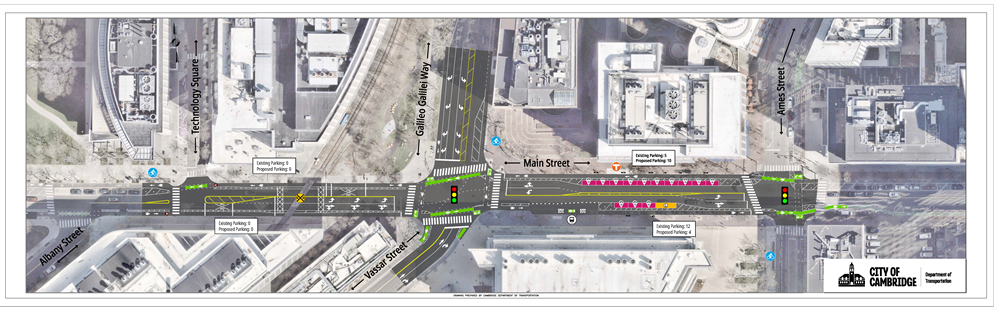
Click here to view a larger roll plan and click here for a legend.
The 2026 Main St Safety Improvement Project has a different design for each block it spans:
Tech Square to Vassar Street
This block of Main Street is too short and too close to the railroad tracks to fit in any parking. Compare the existing and proposed street layout below:
| Existing Cross Section | Proposed Cross Section |
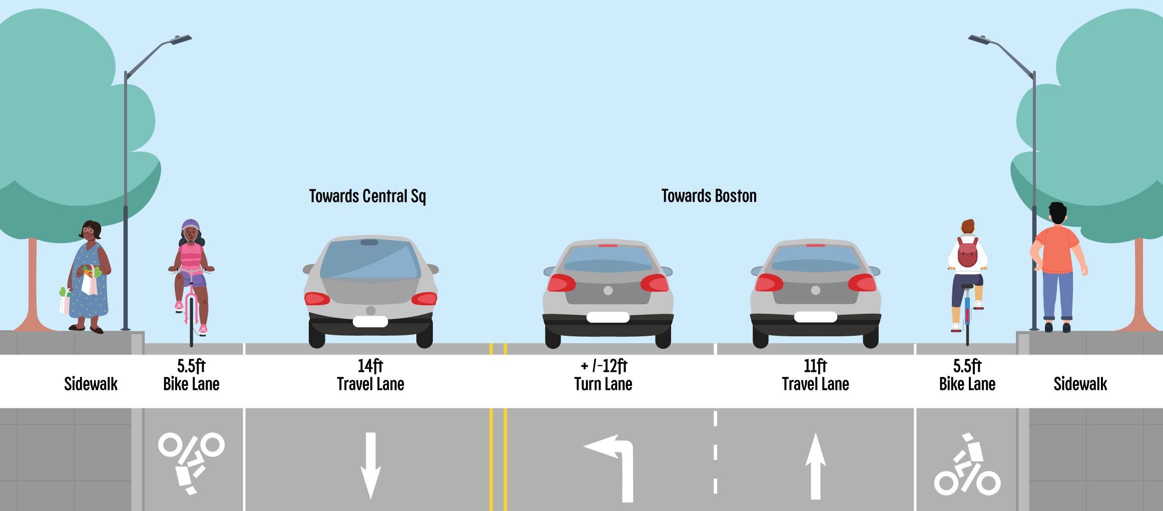 Click here to view a larger image. |
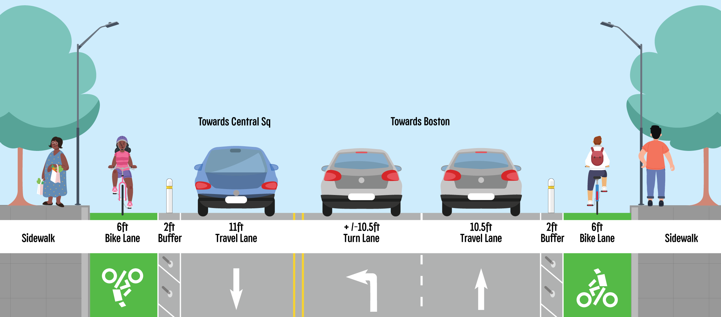 Click here to view a larger image. Click here to view a larger image. |
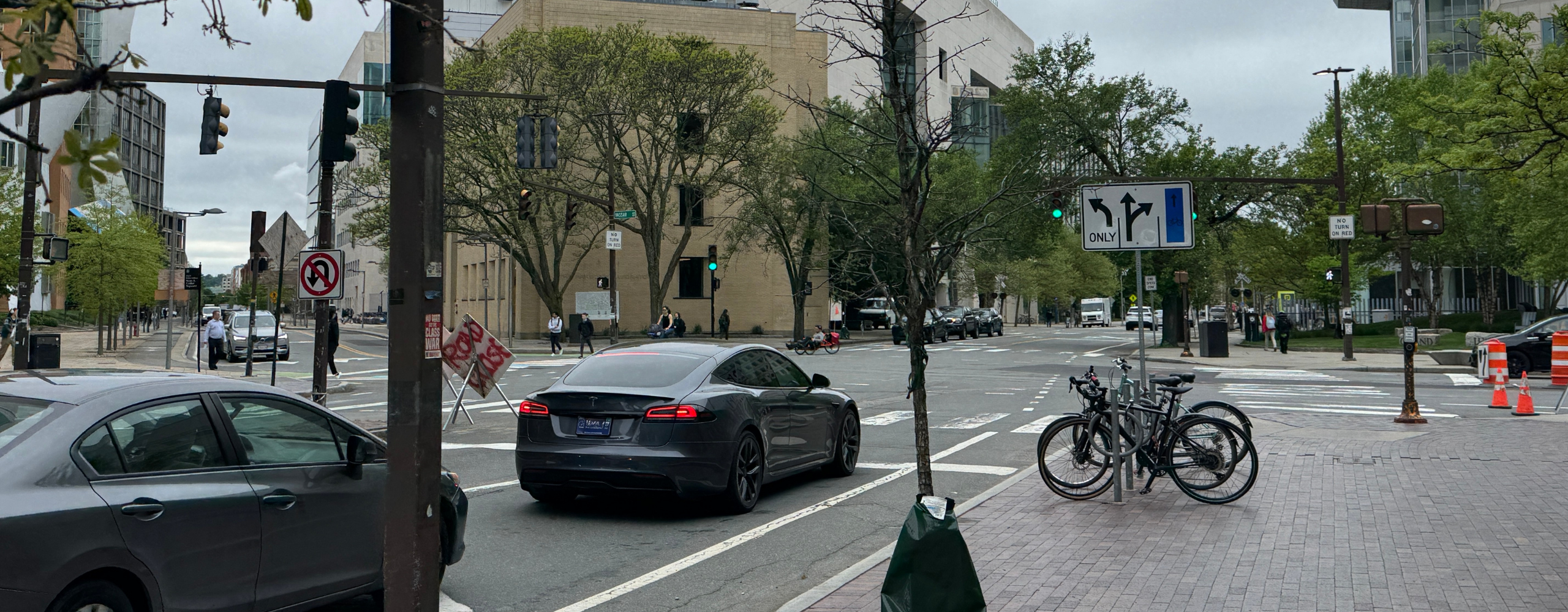
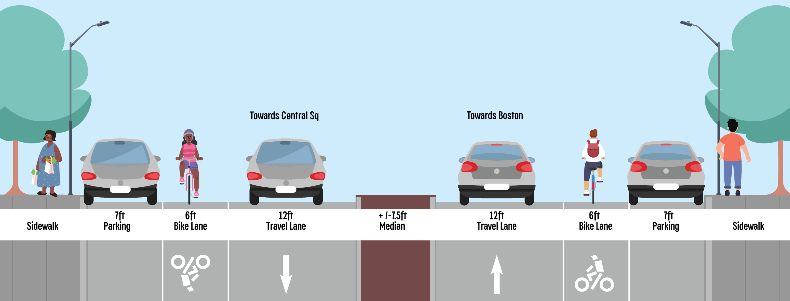
Vassar Street to Ames Street
This block of Main Street includes metered parking, turn lanes, and a bus stop. Compare the existing and proposed street layout below:
| Existing Cross Section | Proposed Cross Section |
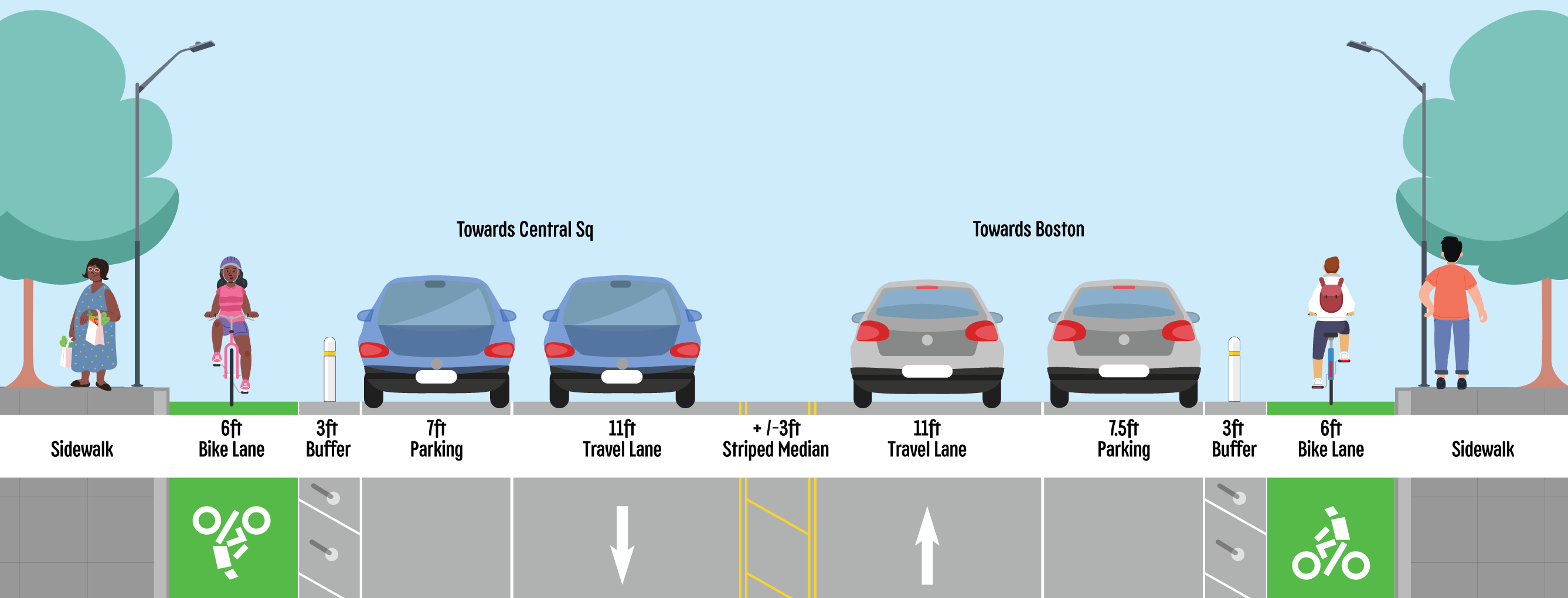 Click here to view a larger image. |
We are accepting feedback via our comment form and email/phone on these plans until June 30. Then we will make additional adjustments based on feedback before the plans are final. Click here to view the plans at a higher resolution.