Street Characteristics
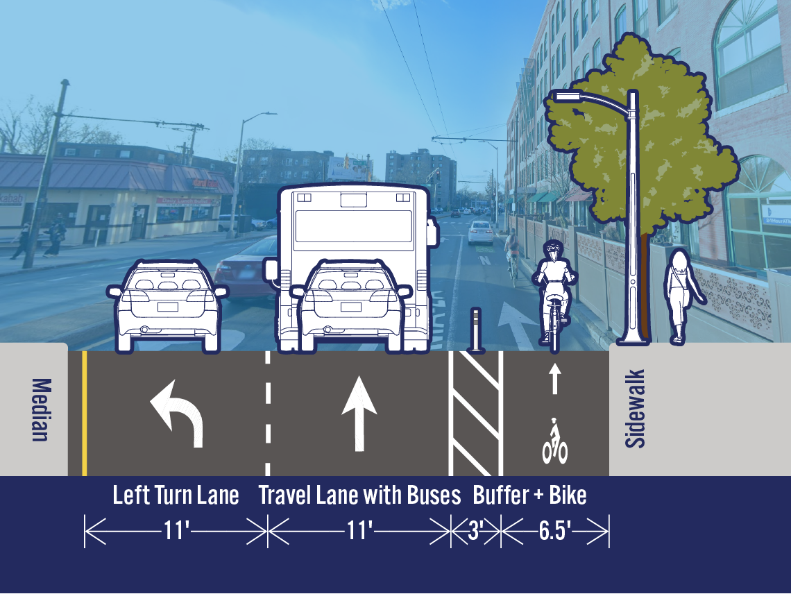
Potential
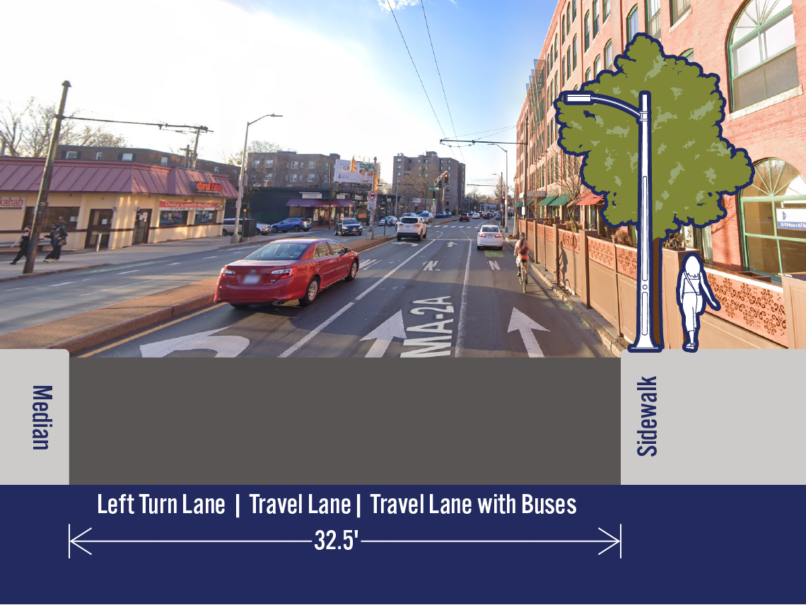
Existing
at Walden St
Note: The width shown in the existing cross-section includes a 1‑foot offset from the median. This offset exists today and is shown, but not labeled, in the potential cross-section.
The curb use information includes a count of existing spaces. The land use information gives general information about the types of land uses.
Curb Use
No Stopping: entire block
Land Use

Retail - General

Retail - Restaurant

Educational Institution - Pre-School or Grade School

Office

Other - Bank

Other - Gas Station
Impacts on Massachusetts Ave
Motor Vehicle Trips
Severe - In order to add separated bike lanes in this location, we would have to remove a travel lane. As a result, traffic would be significantly delayed, especially during the evening peak period, when northbound traffic volumes are the highest. Traffic would be backed up to at least Somerville Ave. This also means that nearby intersections would be blocked and that there may be a significant increase in cut-through traffic on adjacent neighborhood streets. Drivers may become frustrated by the delays and engage in poor behavior. These actions could have significant impacts on the safety of vulnerable users on Massachusetts Ave and streets in the surrounding area. Specifically, we would expect to see a number of people drive in the separated bike lane, make illegal U-turns, drive in the oncoming lane to turn onto side streets, and block intersections. Backups would be most severe during the morning and evening peak periods, but at all times of the day, trip lengths would be significantly longer than they are now.
Bus Trips
Extreme - Before the COVID-19 pandemic, there was an average of 3,279 bus riders who passed through this location each weekday. We studied bus reliability and delay and found serious issues here. If quick-build separated bike lanes are installed here, the impact for bus riders would be extreme. While people who are in personal motor vehicles would experience severe delays and may opt to take alternate routes, the impacts on the bus system would reach much further. We know that these delays would result in unreliability and delay on other sections of routes 77, 77A, 83, and 96. The MBTA works to ensure that schedules accurately reflect travel times. They would adjust schedules so that each bus has enough time to complete its route. The time between buses would be increased and riders would have to wait longer for the next bus to arrive. Overall, these routes have an average daily ridership of 11,075 people, and all of those riders would be impacted even if they don’t travel through this specific block.
Curb Access
No change - There is not currently parking or loading in this segment.
Impact of Stopping in a Travel Lane
No change - This location would still have two travel lanes. Therefore, someone stopping in one of the lanes would likely result in the same outcome as it does today.
Impacts on Side Streets
Traffic on Other Streets
Expected increase - Due to the severe impacts on motor vehicle throughput we expect that some number of people would choose to take a different route. While some drivers may choose other arterials, many drivers might opt to use smaller, local roads that are less suited to higher volumes of traffic.
Curb Access on Side Streets
No evaluation needed - There is not currently loading or parking in the segment of Massachusetts Ave, so we do not need to consider how to shift the existing uses to the side streets.