U.S. flag

An official website of the United States government

Official websites use .gov
A .gov website belongs to an official government organization in the United States.

Secure .gov websites use HTTPS
A lock ( ) or https:// means you’ve safely connected to the .gov website. Share sensitive information only on official, secure websites.

Photograph of numerous people sitting in a sunny park with a sculpture in the background

Urban Form

The city is home to a vibrant mix of architectural styles, as well as unique commercial districts and corridors. This makes Cambridge an exciting and pleasant place to live, work, learn, and play. Additionally, a strong economy means that some areas of the city are undergoing change. These include the major squares and mixed-use corridors, as well as formerly industrial districts, and areas next to parkways and institutions. Cambridge works with developers to provide community benefits and ensure that the urban form of new districts advances the community’s values and complements existing neighborhoods.

Envision indicators are updated as new data becomes available, which varies by indicator, but no more often than annually.

View the Urban Form Plan

Key Actions

Develop design guidelines for as-of-right affordable housing development.

StrategyRevise the development review process to create predictable outcomes without compromising design quality.
Core Values
  • Community Health & Wellbeing
  • Economic Opportunity
  • Equity & Diversity
  • Livability
  • Sustainability & Resilience
Action TypeOther regulatory changes
Lead DepartmentCDD
StatusCompleted

Conduct a citywide assessment to determine where new public or publicly accessible open space should be added as part of redevelopment projects.

StrategyLeverage private development to create and maintain high-quality public open spaces and to provide dynamic programming.
Core Values
  • Community Health & Wellbeing
  • Economic Opportunity
  • Equity & Diversity
  • Learning
  • Livability
  • Sustainability & Resilience
Action TypeStudy or plan
Lead DepartmentCDD
StatusIn Progress
Project PhaseFinal phase

Create open space and recreational facilities with a wide range of uses that meet the needs and interests of Cambridge’s diverse population.

StrategyImprove the public open space network by preserving, maintaining, and enhancing existing open spaces to serve a diverse population.
Core Values
  • Community Health & Wellbeing
  • Economic Opportunity
  • Equity & Diversity
  • Learning
  • Livability
  • Sustainability & Resilience
Action TypePrograms and operations
Lead DepartmentCDD
StatusIn Progress
Project PhaseOngoing

Initiate district plans for specific areas to develop new zoning approaches and design guidelines that support the Envision Cambridge objectives.

StrategyProactively guide development in areas with a strong potential for change through area-specific planning and development review.
Core Values
  • Economic Opportunity
  • Equity & Diversity
  • Livability
  • Sustainability & Resilience
Action TypeStudy or plan
Lead DepartmentCDD
StatusIn Progress
Project PhaseMiddle phase

Update the citywide urban design objectives in the City’s zoning ordinance to reflect Envision Cambridge recommendations.

StrategyRevise the development review process to create predictable outcomes without compromising design quality.
Core Values
  • Community Health & Wellbeing
  • Equity & Diversity
  • Livability
  • Sustainability & Resilience
Action TypeZoning Changes
Lead DepartmentCDD
StatusIn Progress
Project PhaseMiddle phase

Establish citywide guidelines for programming, design, signage, and maintenance and operations of publicly accessible private open space.

StrategyLeverage private development to create and maintain high-quality public open spaces and to provide dynamic programming.
Core Values
  • Community Health & Wellbeing
  • Equity & Diversity
  • Livability
  • Sustainability & Resilience
Action TypeOther regulatory changes
Lead DepartmentCDD
StatusIn Progress
Project PhaseEarly phase

Establish design guidelines for all mixed-use corridors.

StrategyEncourage activity on the ground floors of new buildings, particularly along mixed-use corridors.
Core Values
  • Livability
  • Sustainability & Resilience
Action TypeOther regulatory changes
Lead DepartmentCDD
StatusIn Progress
Project PhaseMiddle phase

Establish public realm design guidelines for street infrastructure, landscaping, trees, seating, and public art to provide a greater sense of continuity between open spaces

StrategyExpand the public open space network through new open spaces, new programming, and improved local and regional connections.
Core Values
  • Community Health & Wellbeing
  • Equity & Diversity
  • Livability
  • Sustainability & Resilience
Action TypeOther regulatory changes
Lead DepartmentCDD
StatusIn Progress
Project PhaseMiddle phase

View All Actions

Indicators

Cumulative percent of new housing units within a 0.5-mile walk to an MBTA subway station

Improving

New development density is best suited for places well-served by urban amenities such as transit. This indicator tracks whether housing development in Cambridge is distributed in areas with a high concentration of urban amenities, using transit as a proxy.

Source: Housing Starts data from CDD
View More Information

Percent of new commercial gross floor area within a 0.5-mile walk to an MBTA subway station

Exceeding target

New development density is best suited for places well-served by urban amenities such as transit. This indicator tracks whether commercial development in Cambridge is distributed in areas with a high concentration of urban amenities, using transit as a proxy.

Source: Development Log data from CDD
View More Information

Population in proximity to park types

Needs improvement

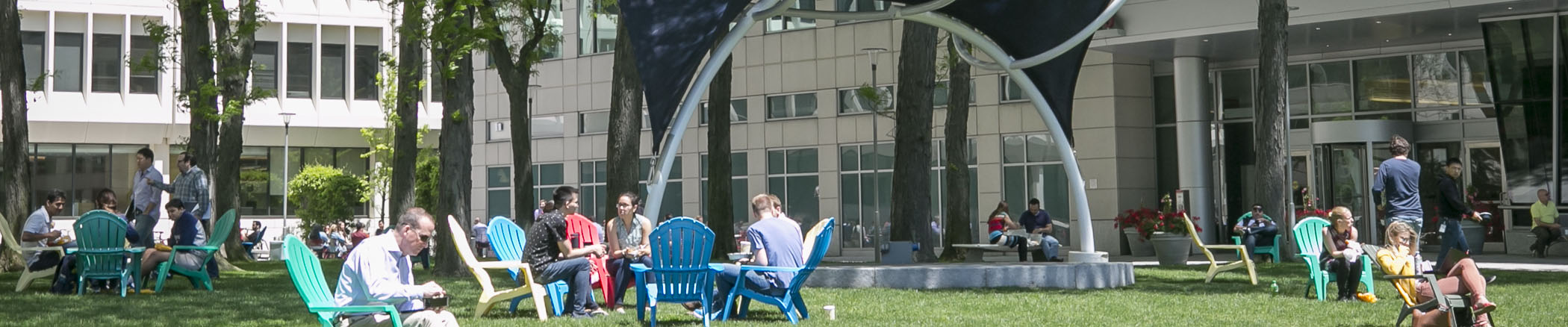
Cambridge has many high-quality open spaces, serving different needs for people at different times. Through this indicator, Cambridge will track whether the community has access to several kinds of park uses, increasing the likelihood that they can find a nearby open space that serves their needs. This metric uses a revised standard introduced by the Open Space Needs Assessment.

Source: Park Types from CDD Open Space Needs Assessment; Population from 2010 and 2020 Census, Annual Housing Starts data from CDD
View More Information

Tree canopy over streets and sidewalks

Improving

The tree canopy covering our streets and sidewalks has a significant impact on the comfort of pedestrians, as well as the public health, sustainability, resilience, visual appeal, and livability of the city as a whole. This indicator will track street trees’ contribution to creating a more healthy, resilient, and pleasant environment by measuring the amount of roadway area that is under the tree canopy.

Source: University of Vermont Spatial Analysis Laboratory in collaboration with City of Cambridge; Cambridge Assessing Department
View More Information

Percent of survey respondents that rate Cambridge's overall appearance as good or excellent.

Meeting target

Most people have an intuitive understanding of what makes the design of a city great, whether or not they have formal design training. Of course, reasonable people can disagree on designs they like. Nonetheless, this indicator tracks Cambridge’s progress in building a city that people find aesthetically pleasing overall.

The chart shows the percent of survey respondents that rate Cambridge's overall appearance as "good" or "excellent" (survey responses collected by calls to randomly selected Cambridge phone numbers).

Source: City Manager's Biennial Survey
View More Information

Acres of publicly owned open space

Improving

As Cambridge grows, it is imperative that the amount of open space relative to the number of people remains at a healthy level. This indicator tracks the amount of space. Though privately owned public spaces are also an important component of Cambridge’s open space inventory, this indicator specifically tracks the amount of publicly owned open space.

The chart shows the total acreage of publicly-owned open space in Cambridge over time.

Source: CDD GIS land use data
View More Information
Contact Us

How can we help?

Please provide as much detail below as possible so City staff can respond to your inquiry:

As a governmental entity, the Massachusetts Public Records Law applies to records made or received by the City. Any information received through use of this site is subject to the same provisions as information provided on paper.

Read our complete privacy statement


Service Requests

Enter a service request via SeeClickFix for things like missed trash pickups, potholes, etc., click here