Tuesday, June 23, 2026: Project Open House
Tuesday, June 23rd, 2026
6:00 p.m. - 8 p.m.
King Open School Gym
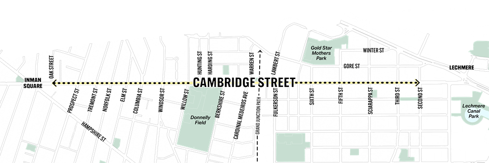
830 Cambridge Street
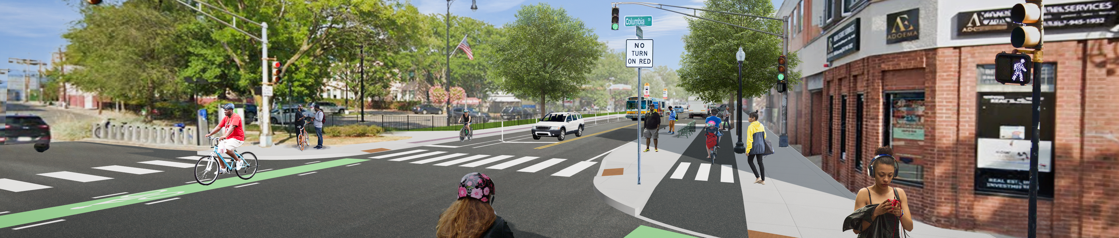
At this open house, we will share final design plans for Section A and Section C of the project. Staff will be available to answer questions and take feedback.
Click here to view the city's calendar item.
Meeting Materials
Wednesday, April 29, 2026: Virtual Information Session
Wednesday, April 29
6 p.m. to 8 p.m.
Zoom
At this April 2026 Virtual Information Session, City staff provided project updates, shared preliminary design plans, and presented an updated project timeline. Community members had an opportunity to ask questions and received answers after the presentation from the Project Team.
Meeting Materials
Tuesday, April 7, 2026: Project Working Group Meeting 6
Tuesday, April 7, 2026
4:00 p.m. to 6:30 p.m.
City Hall Annex Building, 2nd floor Conference Room
344 Broadway
At the sixth Working Group meeting for the Cambridge Street Safety Improvement Project working group members discussed:
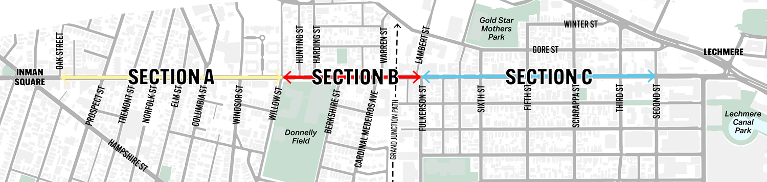
- Updated plans for Section A.
- A brief update on Section B.
- Draft plans for Section C.
Meeting Materials:
Wednesday, August 27, 2025: Project Working Group Meeting 5
Wednesday, August 27, 2025
4:00 p.m. to 6:00 p.m.
City Hall Annex Building
344 Broadway
At the fifth Working Group meeting for the Cambridge Street Safety Improvement Project working group members discussed:
- Near-final plans for Section A between Prospect St and Willow St.
- Utility work planned for the Cambridge St corridor.
- Look ahead for what to expect on future sections of the project.
Meeting Materials:
Tuesday, March 18, 2025: Project Working Group Meeting 4
Tuesday, March 18, 2025
4:00 p.m. to 6:00 p.m.
City Hall Annex Building
344 Broadway
At the fourth Working Group meeting for the Cambridge Street Safety Improvement Project, staff with the Community Development Division (CDD) presented on the city's Flexible Parking Corridors initiative, and members reviewed the plans and flyers for the Oak St to Prospect St installation.
Click here for more information.
Meeting Materials:
Thursday, January 23, 2025: Project Working Group Meeting 3
Thursday, January 23, 2025
4:00 p.m. to 6:00 p.m.
City Hall Annex Building
344 Broadway
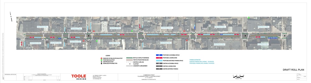
At the third Working Group meeting for Cambridge Street Safety Improvement Project, members reviewed the design plans for Section A of the Cambridge St Project.
Meeting Materials
Monday, December 16, 2024: Project Working Group Meeting 2
Monday, December 16, 2024
11:00 a.m. to 1:30 p.m.
City Hall Annex Building
344 Broadway
At the second Working Group meeting for the Cambridge Street Safety Improvement Project, we discussed timelines of City ordinances regarding bike lanes and certain design limitations. The conversation followed with a Section A site walk of the Cambridge Street project from Oak to Willow, ending with a Working Group discussion at the Valente Public Library.
Meeting Materials
Monday, December 2, 2024: Project Working Group Meeting 1
Monday, December 2, 2024
4:00 to 6:00 p.m.
City Hall Annex Building
344 Broadway
At the first Working Group meeting for the Cambridge Street Safety Improvement Project, we introduced Working Group members and discussed what we're hoping to achieve in the coming months.
Tuesday, December 12, 2023: Phase 1 Virtual Community Meeting
Tuesday, December 12
6 p.m. to 8 p.m.
Zoom
At this virtual meeting, we introduced the project, provided background on related City policies and plans, talked about what we know about the project so far, and left time for public comment. We are currently in the planning stages for this project and do not yet have a plan for the street. Your feedback now will help guide us as we develop concepts for community review.
Materials
Learn more
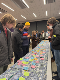
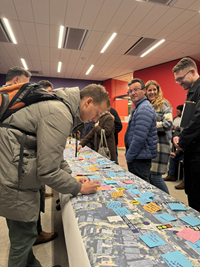
December 2, 2023: Phase 1 In-Person Open House
Saturday, December 2, 2023
Noon to 2 p.m.
Millers River Apartments
15 Lambert St.
At this open house, we introduced the goals of the project, asked attendees about their experiences with the street, gathered feedback on safety concerns, and answered questions.
Materials

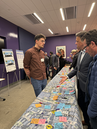
November 29, 2023: Phase 1 In-Person Open House
Wednesday, November 29, 2023
4 p.m. to 6:30 p.m.
Valente Branch of the Cambridge Public Library
826 Cambridge St.
At this open house, we introduced the goals of the project, asked attendees about their experiences with the street, gathered feedback on safety concerns, and answered questions.
Materials


 The Safety Improvement Project on Cambridge Street will build off the feedback you shared during the City's recent Our Cambridge Street plan.