Facts and Maps
 Getting Around Cambridge street map
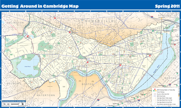
Example of GIS map. This map includes the locations of MBTA Red Line and Green Line stops, MBTA bus routes, bike paths and walking paths. Also included are arrows giving the direction of one way streets found throughout the city. View the map.
Data useful for different aspects of planning takes many different forms. Planners use data for two main purposes. Data can measure existing "conditions on the ground". Data can also project future conditions based on decisions taken today. Examples include:
- Counting members of a population or their characteristics;
- Converting land use and other physical conditions into digital form;
- Measuring the value of economic transactions; and
- Evaluating the characteristics of the built environment.
Data compiled into a useful form becomes information. Information is available here in several formats. These include tables, reports, presentation slides, and maps.
We collect data from many sources. Important ones include the U. S. Census Bureau, the Massachusetts Executive Office of Labor and Workforce Development, the Cambridge Assessing data system, the Cambridge Geographic Information System (GIS), the Cambridge Inspectional Services Department, the Cambridge Public Schools Department, and Cambridge-based post-secondary educational institutions.
For More Information
For more information CDD maps and GIS data, contact Brendan Monroe at bmonroe@cambridgema.gov or 617-349-4641.
For assistance with other data-related questions, contact Scott Walker at swalker@cambridgema.gov or 617-349-9462