Open Space Map Gallery
Maps showing the locations of public open space and related features throughout Cambridge.
 |
Public Parks, Playgrounds and Reservations Map
This comprehensive map shows all of the major public open spaces in the city and contains information about the basic amenities that can be found at each. Learn more about Cambridge parks.
|
 |
Waterplay Locations Map
Many Cambridge parks and playgrounds feature water play sprinklers, which come in a variety of different types and sizes. Find one near you and beat the summer heat!
|
 |
Community Gardens Map
Many locations around the city have gardening space that residents can apply to use. For information about applying for community garden space, contact the Conservation Commission.
|
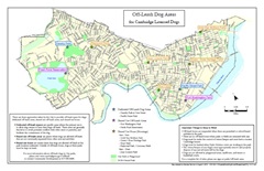 |
Off-Leash Locations Map
There are some dedicated off-leash areas in the city, while other parks have special rules regarding when animals may be allowed off-leash at certain times. See which parks allow some type of off-leash use. Learn more about off-leash park use.
|
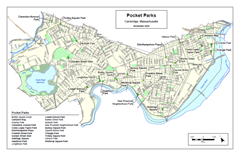 |
Pocket Parks
Cambridge pocket parks are small parks under one acre, with trees, plantings, and places to sit. These parks offer opportunities for relaxation and respite, rather than active recreation.
The Cambridge Plant & Garden Club, in cooperation with the City of Cambridge, developed Discover Cambridge Pocket Parks, a report highlighting several of these spaces. This map identifies locations highlighted in this report.
|
 |
Open Space per 1000 Residents
Using population figures from 2010 U. S. Census, this map provides a visual representation both of the amount of nearby public open space proximate to each Census Block and of the number of residents seeking to use that open space. Learn more about Open Space Planning in Cambridge.
|
For More Information
For more information about these maps and about GIS contact Brendan Monroe at 617/349-4641 or bmonroe@cambridgema.gov.