Other Maps of Interest
A collection of maps on a variety of topics not included elsewhere within the map galleries.
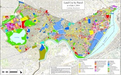 |
Land Use Map
Cambridge land uses by parcel as of July 1, 2023. Based on Assessing Department, Development Log, and building permit data.
|
 |
Neighborhood Revitalization Strategy Area
The Neighborhood Revitalization Strategy (NRS) area is reviewed and updated every five years by Federal Grants staff. The NRS area is divided into two zones, in East and West Cambridge, and includes primarily residential neighborhoods and adjacent small business corridors.
|
 |
Institutional Ownership
Property owned by Cambridge College, Harvard University, Lesley University, and the Massachusetts Institute of Technology including both commercial and nontaxable properties. This map is updated each year following the completion of the Town Gown reporting process.
|
For More Information
For more information about these maps and about GIS contact Brendan Monroe at 617/349-4641 or bmonroe@cambridgema.gov.