-
The Geographic Information System team attended the world’s largest conference devoted to GIS and mapping technology.
-
Team leads shared examples of community engagement and climate resiliency using 3D visualizations and analysis.
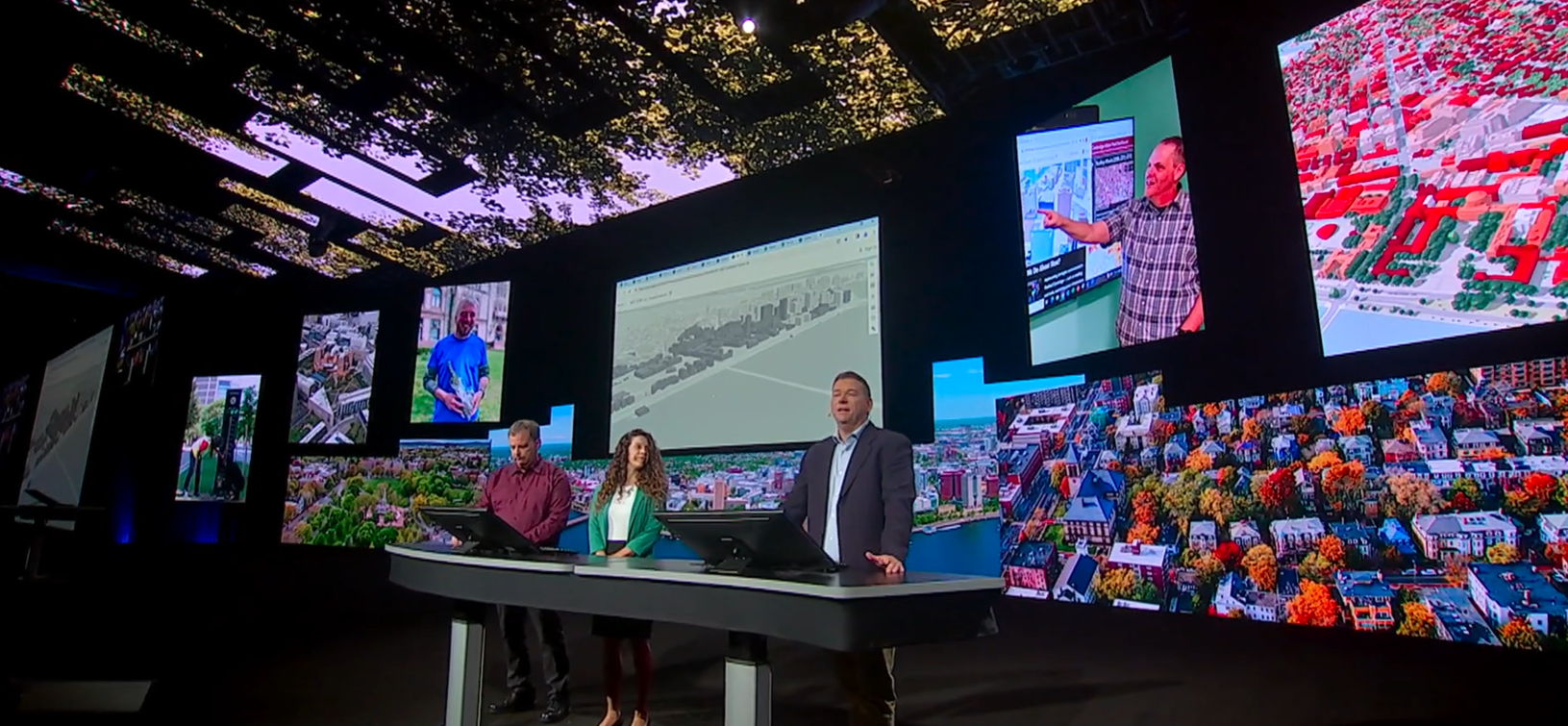
The Cambridge Geographic Information System (GIS) team was invited to attend the world’s largest conference devoted to this mapping technology. GIS Manager Jeff Amero, and GIS Web Technology Specialist Katie Grillo, in collaboration with Bill Witts from MIT Facility Information Systems, presented on the Plenary stage at the annual Esri User Conference in San Diego in July 2023.
The event had more than 14,000 in-person attendees, along with thousands more viewing via a live stream. Exploring the theme of 3D visualizations and analysis, Cambridge GIS shared examples of this technology and its use in community engagement and climate resiliency.
The presentation started by showing the Cambridge Neighborhood 3D Web Scene, which allows residents to navigate and explore the city in 3D. This map includes a variety of familiar 2D features brought to life in 3D. The Cambridge GIS custom basemap includes many features — including parking spots, crosswalks, and bicycle lanes — that provide the necessary backdrop for all these mapping tools.
“We have found that providing a 3D base map has made outreach with our diverse and engaged community easier,” says Amero. “We are always looking for new ways to leverage our decade-long investment in 3D GIS to support new analysis and visualizations for city staff and the public.”
Another resource for the public is the collection of crowdsourcing maps. By using these tools, residents can bring attention to specific areas of concern throughout the city. In return, city staff can review comments using a 3D visualization. This helps ensure that the urban planning team is targeting areas that need the most urgent attention. Their presentation at Esri User Conference is a testament to the strength and expertise of this team and the GIS program at the City.
In addition to these visualizations, the Cambridge GIS team also focuses heavily on analysis. Based on several canopy assessments conducted by the University of Vermont, the City of Cambridge is taking the initiative to fully understand the changes in our urban forest. In addition to studying the tree canopy, Cambridge is also using GIS technology to help cool the City. Much of Cambridge is covered by buildings and by using 3D GIS to help understand roof characteristics, the City has created green building requirements that aim to reduce the urban heat effect. “Our Envision Cambridge, Resilient Cambridge and Urban Forest Master plans create a roadmap to reduce urban heat through redesigning streets and creating more resilient forest, that shades our transit corridors,” says Jeff Amero.
In many ways, the Cambridge GIS team has shown itself to be an international leader in Geographic Information System technology. They have visualized the City of Cambridge with several interactive 3D web maps that have allowed the city to stay on top of community needs, climate change resiliency, and much more. Their presentation at Esri User Conference is a testament to the strength and expertise of this team and the GIS program at the City.
Readers can learn more about Cambridge GIS at www.cambridgema.gov/GIS