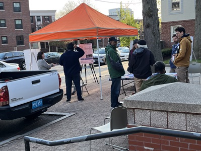
Open House On-Street Pop Up: Tuesday, April 22, 2025
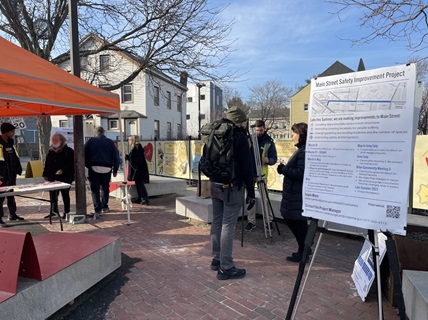
On Tuesday, April 22, 2025 from 4:30 p.m. to 6:00 p.m., we hosted a project open house at the Intersection of Bishop Allen Drive and Main Street.
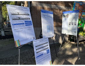
Meeting Materials
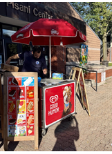
Open House at the Pisani Center: Thursday, April 17, 2025
On Thursday, April 17, 2025 from 5:30 p.m. to 7:00 p.m., we hosted a project open house at the Pisani Center, 131 Washington Street.
Meeting Materials
Virtual Information Session: Tuesday, April 15, 2025
On Tuesday, April 15, 2025 from 6 p.m. to 7 p.m., we will host a virtual information session for the project. This will serve as an update on the project following a change in timeline due to City Council action requiring staff to pause the project. Click here for more information.
View the recording here.
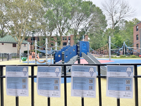
Thursday, September 14: Ice Cream Party
The Main Street Safety Improvement Project Ice Cream Party!
On Thursday, September 14, from 4 p.m. to 6 p.m. we hosted an ice cream party to review draft project designs at the Pisani Center (131 Washington Street)

At this event we:
- Enjoyed free ice cream
- Learned more about the project
- Residents shared their thoughts on:
- What side of the street should parking go on?
- What types of parking should we keep?
Translation and interpretation was available in Haitian Creole, Spanish, and Amharic.
Review materials shared at the event:
Couldn't make it? Take the survey.
Sign up for the project email list to learn more about upcoming events.
Open House at Intersection of Main Street/Bishop Allen Drive: Thursday, June 8, 2023
On Thursday, June 8, from 4:30 p.m. to 6:30 p.m., the City of Cambridge hosted an open house for the Main Street Safety Improvement Project at the plaza at the intersection of Main Street and Bishop Allen Drive.
The open house provided an opportunity for the community to drop by in-person to talk to city staff, ask questions, and provide feedback. Information presented at the open house was similar to what was presented at the May 31 virtual community meeting for the project.
The open house will consist of display boards showing the following:
- Design alternatives based on community feedback
- An introduction of the project, its goals, and its objectives
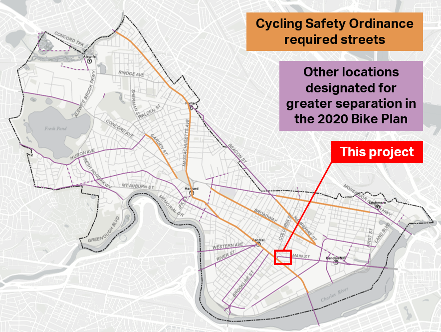
- A review of background and planning information, including the Cycling Safety Ordinance, Cambridge Bicycle Network Vision, and the Vision Zero Action Plan
- The anticipated timeline for the project
Click here to download the boards from the meeting
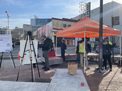
Open House at the Pisani Center: Tuesday, June 6, 2023
On Tuesday, June 6, from 4:30 p.m. to 6:30 p.m., the City of Cambridge will held an open house for the Main Street Safety Improvement Project at the Pisani Center at 131 Washington St.
The open house provided an opportunity for the community to drop by in-person to talk to city staff, ask questions, and provide feedback. Information presented at the open house was similar to what was presented at the May 31 virtual community meeting for the project.
The open house consisted of display boards showing the following:
- Design alternatives based on community feedback
- An introduction of the project, its goals, and its objectives
- A review of background and planning information, including the Cycling Safety Ordinance, Cambridge Bicycle Network Vision, and the Vision Zero Action Plan
- The anticipated timeline for the project
Click here to download the boards from the meeting
Second Online Community Meeting: Wednesday, May 31, 2023
On Wednesday, May 31 from 6 p.m. to 8 p.m., the City of Cambridge will held the second community meeting for the Main Street Safety Improvement Project on Zoom.
During the meeting, we:
- Shared design options for adding quick-build separated bike lanes based on community feedback. To fit the bike lanes, we will have to remove a significant number of parking spaces. The design options will have parking and bike lanes in different layouts on the street
- Summarized feedback received on the project so far
- Reviewed background and planning information, including the Cycling Safety Ordinance, Cambridge Bicycle Network Vision, and the Vision Zero Action Plan
- Gave an opportunity to ask questions and provide your feedback
Meeting Materials
Meeting Updates
Please review the slides, recording, or transcript for a full overview of what was discussed during the meeting.
City employees introduced the project; reviewed background and planning information, including information on the Cycling Safety Ordinance, Cambridge Bicycle Network Vision, and the Vision Zero Action Plan; shared a project timeline; and provided an opportunity for community members to ask questions and provide feedback.
With feedback from the first phase of this project, we drafted several design options for the street.
Feedback So Far
We reviewed what we've heard so far at in-person events, via a comment form, and via the online feedback map.
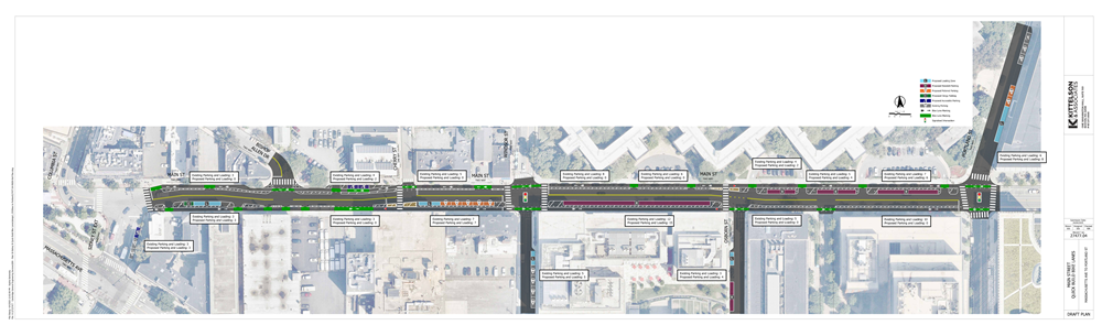
Street Layout Options
We divided the project area into two sections to review layout options. The options show parking in different areas. All options have one-way separated bike lanes along the curb.
Take the Design Options Survey
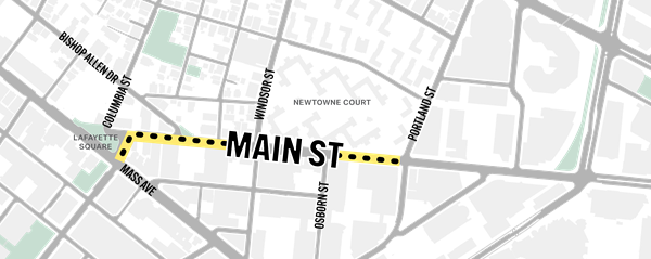
Sidney Street Extension to Windsor Street
Mix of businesses, industrial uses, houses of worship, and residential.
Two layout options:
- Option 1: Parking on the north side of the street (8 spaces + one accessible space)
- Option 2: Parking switches sides (12 spaces + one accessible space)
Windsor Street to Portland Street
Residential (Newtowne Court) on the north side, with businesses and industrial uses on the south side.
Three layout options: (Strong community support for all spaces to be permit parking)
- Option 1: Parking on the north side (19 spaces on the north/residential side of the street)
- Option 2: Parking on the south side (29 spaces on the south side of the street, across the street from residences)
- Option 3: Parking switches sides (22 spaces total: 12 on the south side of the street and 10 on the north/residential side)
Intersection: Main Street at Lafayette Square
Two design options:
- Option 1: Modify existing intersection to improve separation, add bike signals
- Option 2: No thrus at Main or Columbia, protecting some crosswalks from turning vehicles
Open House: Wednesday, April 26, 2023
We hosted an in-person open house on Wednesday, April 26, from 4:30 p.m. to 6:30 p.m. at the Pisani Center (131 Washington St, in between Newtowne Court and Washington Elms).

The open house provided an opportunity for the community to drop by in-person to talk to city staff, ask questions, and provide feedback on the project. Information presented at the open house was similar to information presented at the March 16 virtual community meeting.
The open house included display boards showing the following:
- An introduction of the project, its goals, and its objectives
- Background, including information on separated bike lanes, crash data, and context on Main Street
- Overview of planning information, including the Cycling Safety Ordinance, Cambridge Bicycle Network Vision, and the Vision Zero Action Plan
- Information about how to receive updates about the project
- The expected timeline for the project
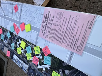
There were also printed maps of the area for attendees to reference in their discussions with staff and to record specific location-based feedback.
Click here to view PDFs of the boards.
Open House: Wednesday, March 22, 2023
We hosted an in-person open house on Wednesday, March 22, from 4:30 p.m. to 6:30 p.m. at the plaza at the corner of Main Street and Bishop Allen Drive.
The open house provided an opportunity for the community to drop by in-person to talk to city staff, ask questions, and provide feedback on the project. Information presented at the open house was similar to information presented at the March 16 virtual community meeting.
The open house included display boards showing the following:
There were also printed maps of the area for attendees to reference in their discussions with staff and to record specific location-based feedback.
View Open House Posters
First Community Meeting: Thursday, March 16, 2023
We hosted the first community meeting for the Main Street Safety Improvement Project on Thursday, March 16, 2023, from 6 p.m. to 8 p.m. on Zoom.
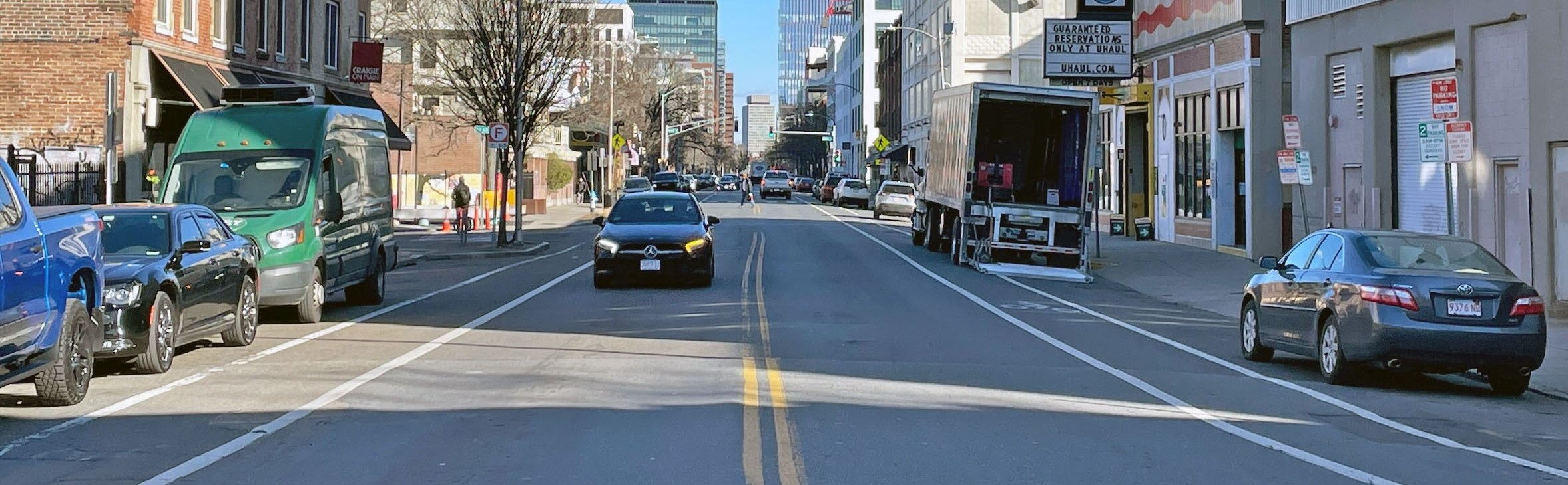
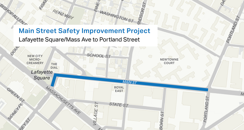
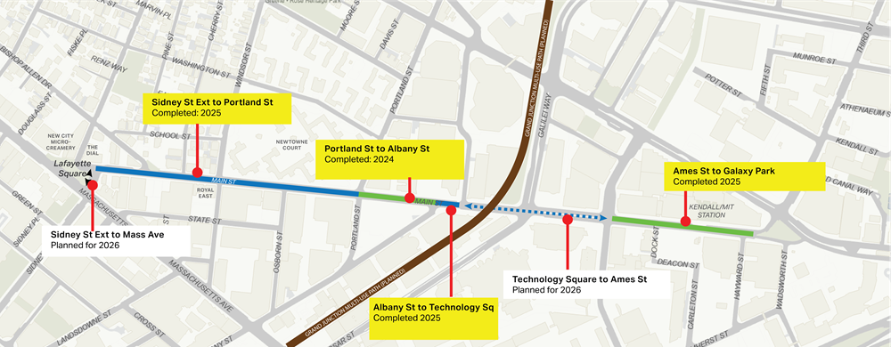
This meeting was the first of several outreach events over the next few months to discuss safety improvements to Main Street between Massachusetts Avenue (Lafayette Square) and Portland Street. Our goals for this project are to install separated bicycle lanes in both directions, improve crossing locations for people walking, identify locations for parking and loading, and address safety at key intersections.
Meeting Materials
Meeting Updates
Please review the slides, recording, or transcript for a full overview of what was discussed during the meeting. City employees introduced the project; reviewed background and planning information, including information on the Cycling Safety Ordinance, Cambridge Bicycle Network Vision, and the Vision Zero Action Plan; shared a project timeline; and provided an opportunity for community members to ask questions and provide feedback.
We are starting the project by gathering feedback before we create draft designs for the street.
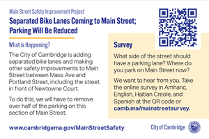
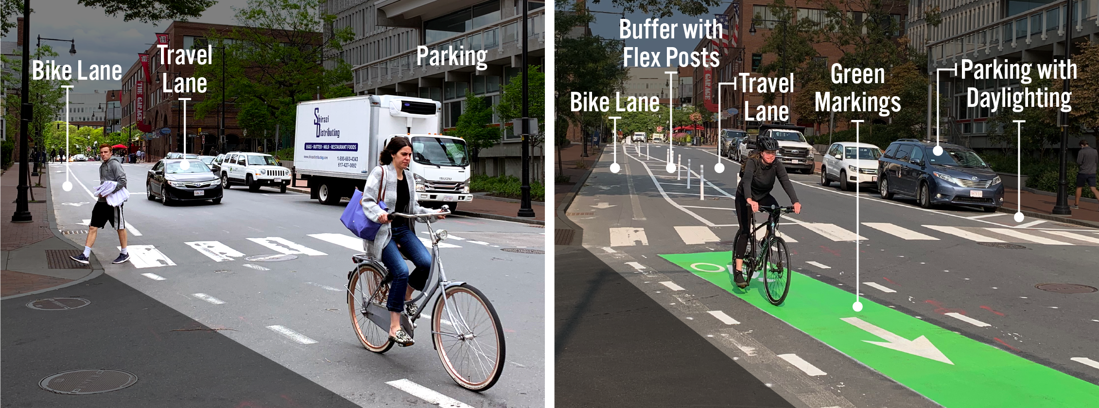
Separated Bike Lanes
We are planning to add separated bike lanes between Massachusetts Avenue and Portland Street. Separated bike lanes physically separate people biking from people driving with extra space and flex posts between the bike lane and car travel lane. This takes up more space on the street than the regular bike lanes in the area now.
Parking
- We will need to remove about half the parking spaces in the project area. This is because separated bike lanes, with the extra buffer area, are wider than the traditional bike lanes there now.
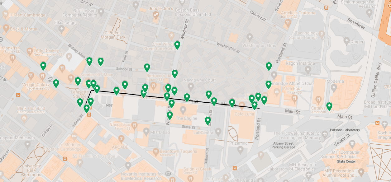
- Right now, there are about 90 parking and loading spaces in the project area. Click here for a map of existing parking types.
We want to hear from you: What types of parking and loading are important to keep? Where?
Crosswalks and Walking
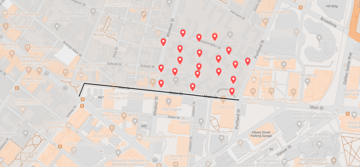
We are making quick-build improvements to existing crosswalks and addressing safety at key intersections. Click here for a map of existing crosswalks.
We want to hear from you: What crossings work well? Which do you have concerns about?
Crash Data
Between 2020 and 2022, there were 34 reported crashes in the project area. Data showed that people walking and biking were more vulnerable to injury. Click here for more information.


